Innovative methods for registering and integrating data from various sources to produce 3D representations of the Palace in Wilanów
Innovative methods for registering and integrating data from various sources to produce 3D representations of the Palace in Wilanów - Photo gallery
Innovative methods for registering and integrating data from various sources to produce 3D representations of the Palace in Wilanów
Innovative methods for registering and integrating data from various sources to produce 3D representations of the Palace in Wilanów - Photo gallery
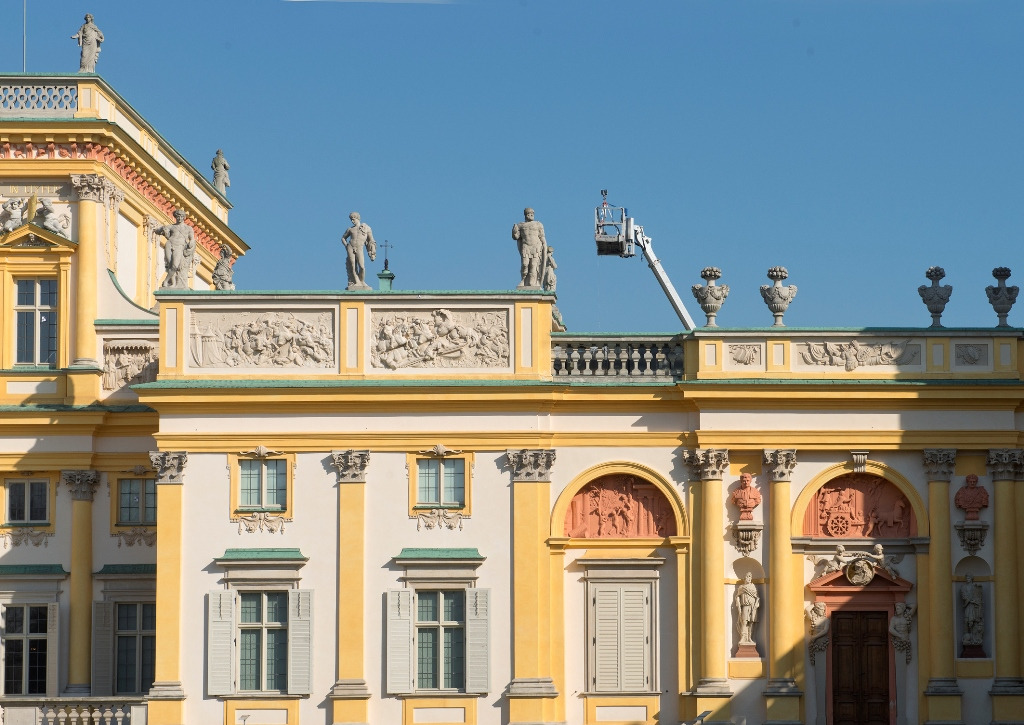
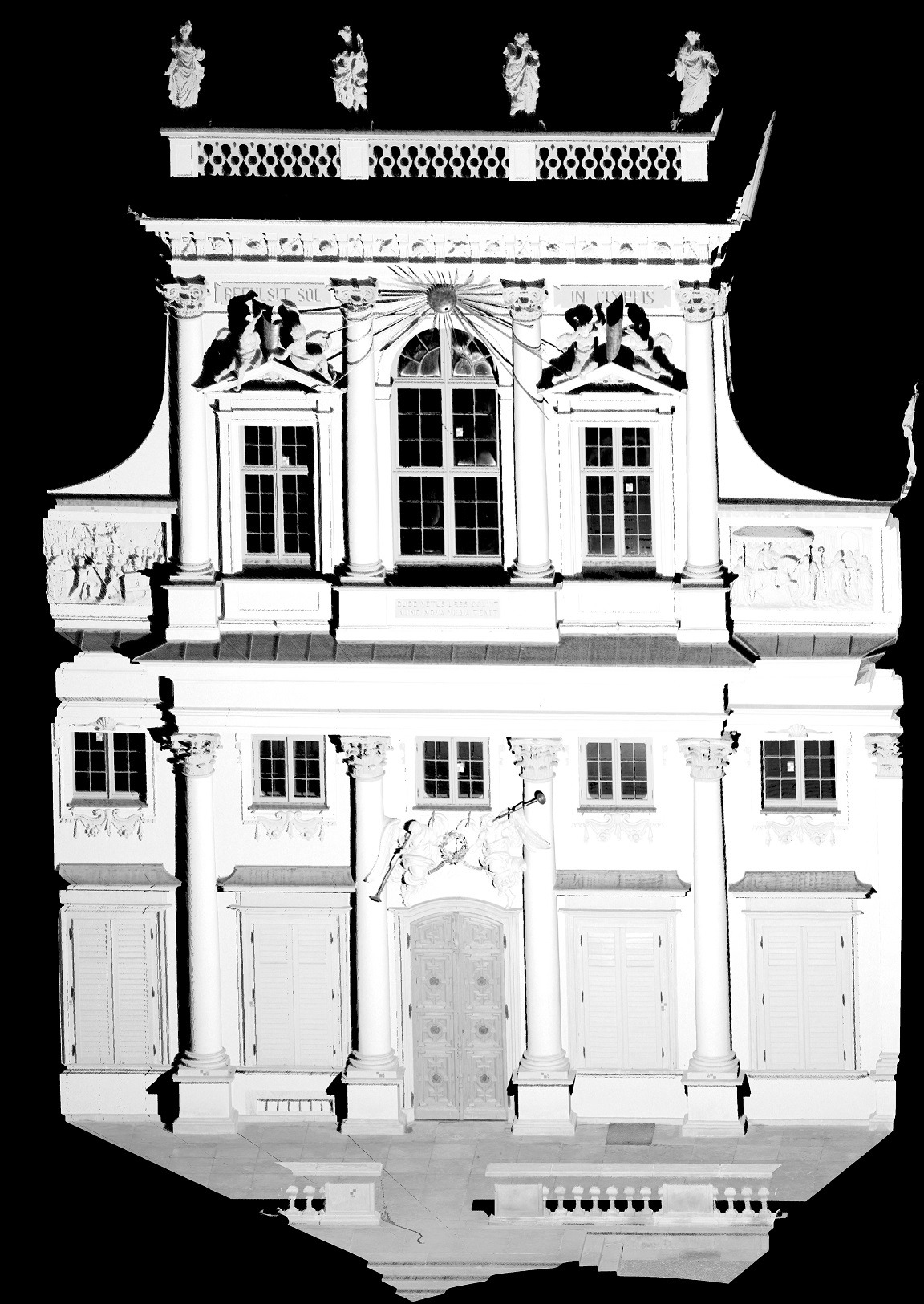
The purpose of the project was to develop a detailed photogrammetric documentation of the external façade of the Wilanów Palace with the sculpture and painting decoration based on integrated data provided by advanced measurement systems and processed into documentation.
The acquired data are the results of a ground-based laser-scanning system (made with a resolution of 2-3 mm for walls and 1 mm for details), and aerial and high-resolution close-range imaging. Due to the integration of various techniques, the photogrammetric documentation obtained within the project meets requirements such as high geometric accuracy and resolution, the inclusion of all details, a varied level of detail and high resolution of the texture.
The field works included measurements with a ground-based scanner, digital images with a non-metric and metric camera with a high resolution, and images of the roof and its decorations using a UAV, which were later processed into a point cloud. The intermediate photogrammetric products were processed, developed, analysed and integrated, as a result of which the cartometric documentation of the condition of the Palace façade was derived. This was followed by the preparation of all data to be included in the museum’s spatial-information system and serve as another base layer of the rendered decorative objects. The documentation functions as a digital and metric inventory of the museum’s condition and supplements the existing records made before the conservation work. This is necessary for recording and analysing changes in the building, i.e. activities associated with preventive conservation. The availability of such data facilitates the analysing and tracking of changes on the Palace’s façades, e.g. micro-cracks or building shifts.
The developed documentation will serve professionals and specialists in conservation, history of arts, history, architecture and photometry, not only as a metric 3D record of the buildings, but also as a basis for further studies and analyses. The material is included in the spatial-information system and supplements the acquired and organised knowledge on the royal residence in Wilanów; it also serves as a tool essential for managing the historic substance. The materials will also be available online for everyone, not only specialists, in the form of a special GIS app developed by the museum, which is a source of knowledge on all museum resources – from historic to natural assets.